Great partnerships lead to
great outcomes
Virtuematic collaborates with the world's foremost companies
to redefine their business strategies and assist in achieving their goals.
Change is constant – Virtuematic services can help you to adapt to those changes.
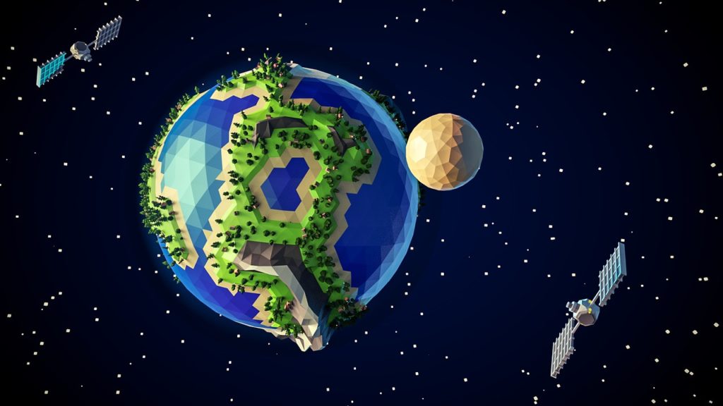
Geographic Data and Information Services
In the ever-evolving geospatial landscape, change is not only constant but faster and more radical than ever before. Enhanced software capabilities, emerging technologies like VR and AR, and unprecedented collaboration avenues usher in a new era of explosive growth. As companies navigate this landscape, exploring possibilities, enhancing customer experiences, and rethinking strategies for growth, they must simultaneously address cost reduction, capital preservation, and meet quality and compliance standards.
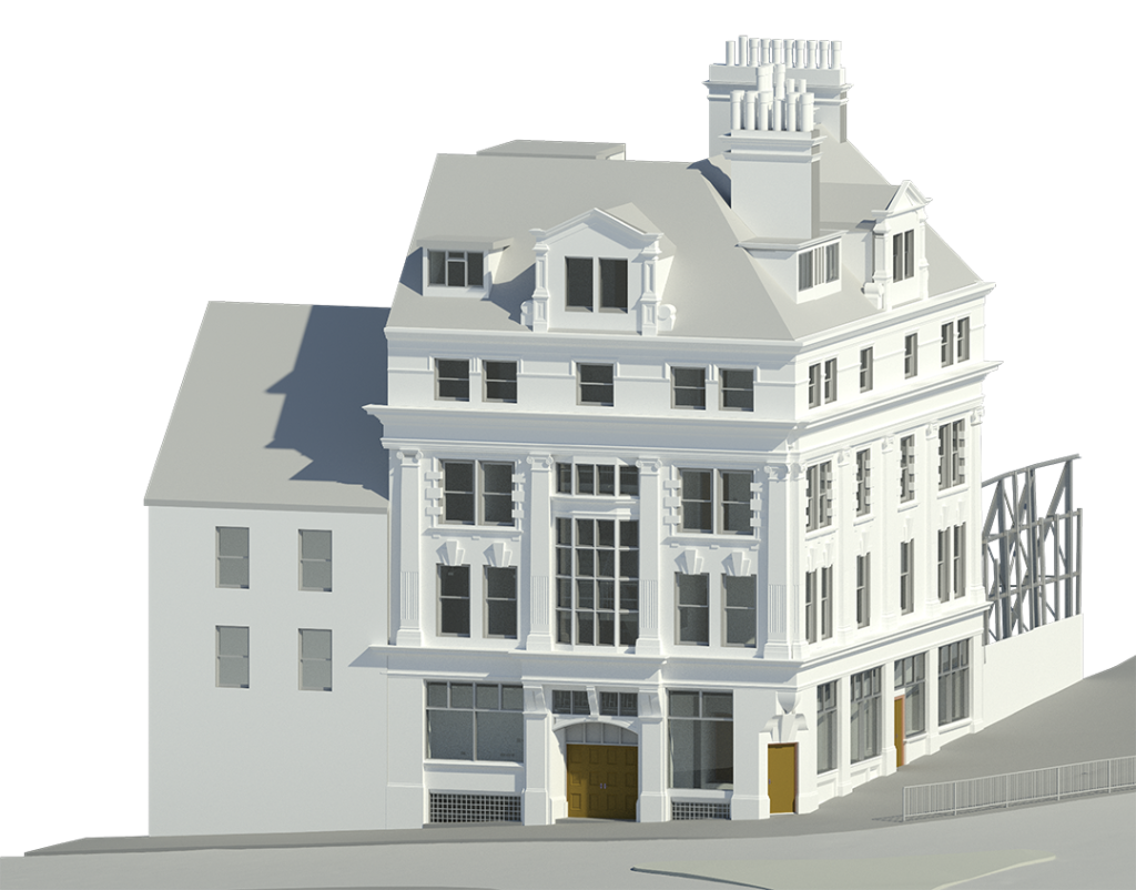
3D Modeling
Virtuematic specializes in providing end-to-end 3D modeling and 2D drawing solutions, facilitating a seamless construction process for companies. Our highly trained team of engineers and architects specializes in CAD, Revit MEP, Architectural, Structural modeling, and 2D drawings. Through a proven implementation of processes and methodologies, we deliver cost-effective services without compromising on quality or turnaround time.
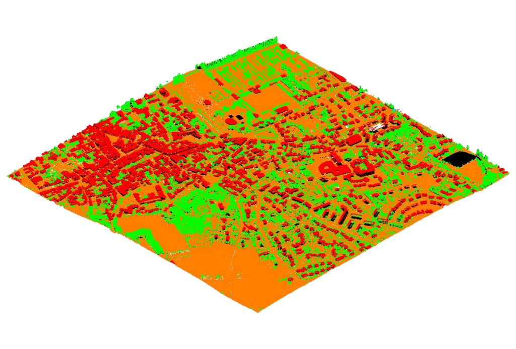
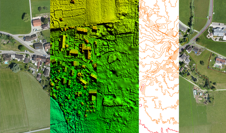
LiDAR Services
Virtuematic offers an extensive array of LiDAR data processing services, enabling the creation of Digital Elevation Models, Digital Terrain Models, Triangulated Irregular Networks, and Contour maps. Our services provide highly accurate details of the Earth’s surface, supporting Digital Cartography, Topography, Highway and Street asset mapping, as well as applications in Transmission/Electrical, Telecommunication, and Flood mapping arenas.
GIS Mapping
Geographic Information System (GIS) has evolved from being a mapping functionality to open standards and web technologies. At Virtuematic, we bring domain expertise to this evolution, empowering utilities to leverage GIS for location advantages and address operational, service, and regulatory needs. Our commitment extends to providing specialized services to local governments, ensuring tailored solutions that meet their unique geographic information requirements.
UAV Services
Virtuematic excels in delivering automated post-processing solutions for UAV flight data, specializing in Digital Terrain Model (DTM) and True Ortho Photo Production. Our automated processes encompass a wide array of services, including advanced triangulation, blunder detection, and bundle block adjustment for precise spatial reconstruction. Beyond these core services, our expertise extends to detailed 3D modeling, providing realistic representations of terrain and structures. We also excel in haul road mapping, delivering insights crucial for efficient logistics and resource management in mining and construction operations. With a focus on mining applications, Virtuematic tailors solutions to map and analyze mining sites, optimizing operations and enhancing safety.
AR | VR Services
Augmented and Virtual Reality continues to drive change everywhere from Manufacturing to healthcare, education, engineering and construction. We help our clients solve problems, making use of new technology. Our in-house specialists design for immersion and always explore the latest innovations and tech.
Augmented Reality
At Virtuematic, we offer augmented reality as a service, seamlessly enhancing elements like pictures, sound, GPS data, and motion to craft captivating and interactive surroundings for our clients. Our expertise extends to providing virtual tours of facilities and construction sites, allowing users to explore and visualize spaces remotely. Additionally, we specialize in simulation, creating immersive experiences that simulate real-world scenarios for training or demonstration purposes. As part of our comprehensive services, we also excel in mobile and web application development, ensuring that our augmented reality solutions are seamlessly integrated into user-friendly platforms for optimal accessibility and engagement.

Virtual Reality
At Virtuematic, we recognize the rapid rise in popularity of Virtual Reality (VR) among global brands, driving an increased demand for high-quality VR content. We meet this demand by offering VR services and solutions that embody the highest levels of realism, image quality, and performance. Our commitment is to deliver a fully immersive and future-proof VR experience, ensuring that our clients stay at the forefront of this dynamic and evolving technology landscape.
Try For Free
Experience Excellence: Try Our Geospatial Services for Free!
We recognize that concerns about quality and delivery timescales may arise when considering offshore partnerships. To address these uncertainties, we offer a sample work or pilot project for any project under our geospatial service line. We create a sample project from the data of your choice, processed entirely free of cost. This allows you to judge the quality of our work without incurring any expenditure. Additionally, we provide accurate costing based on the sample we create, ensuring transparency and clarity. Contact us today to experience the value we bring to each project.