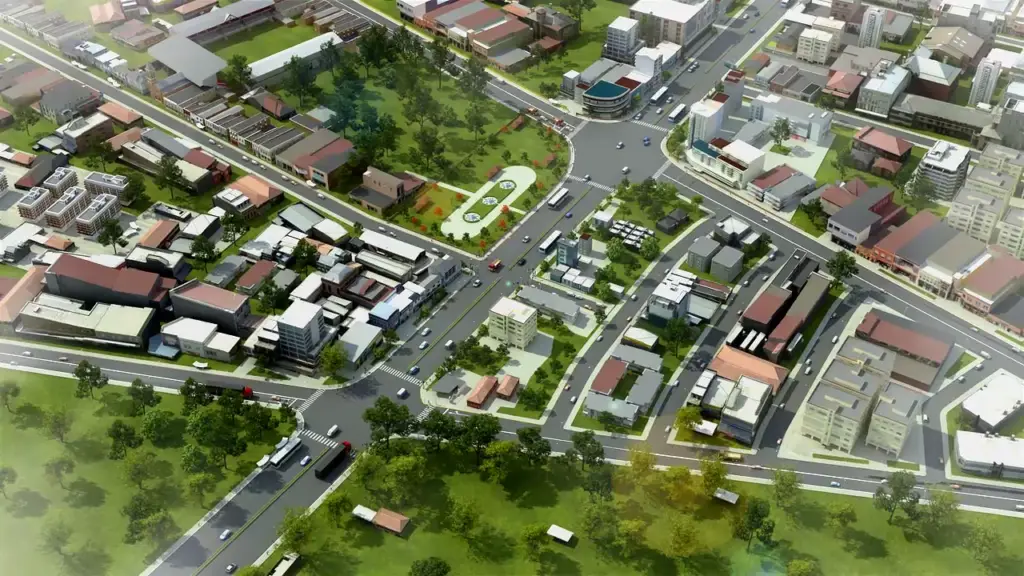
Transforming Geospatial Data into Smarter Solutions
Step into the future of geospatial solutions, where cutting-edge technology meets precision engineering. From LiDAR mapping to BIM integration, we deliver unmatched accuracy, immersive visualization, and innovative tools to transform your projects today and beyond.
Transforming Complex Data into Clear, Actionable Insights
At Virtuematic, we specialize in delivering cutting-edge geospatial solutions tailored to meet the unique needs of industries like construction, urban planning, surveying, and more.
With a focus on precision, innovation, and efficiency, we empower businesses to make smarter decisions through advanced GIS, LiDAR, BIM, UAV, and 2D Drafting services
Transforming laser scan data into precise CAD drawings and intelligent BIM models for architectural, structural, and MEP applications. Our services include:
✔ Floor plans, Elevations, and Sections
✔ As-built 3D models from point clouds
✔ Detailed BIM models for seamless project coordination
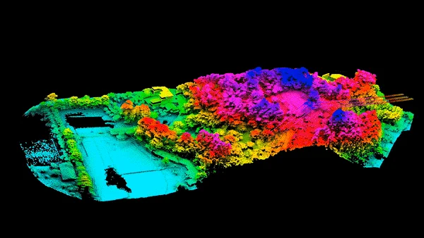
LiDAR Processing for Accurate Geospatial Solutions
We transform raw LiDAR data—captured through vehicle-mounted systems, aerial surveys, and drones—into high-precision terrain models, contour maps, digital twins, and GIS-compatible formats.
Our solutions support infrastructure planning, land development, and geospatial analysis, ensuring accuracy, consistency, and actionable insights for every project.
We process UAV-captured data into high-resolution maps, 3D topographic models, and photogrammetry-based visualizations.
Using drone imagery or Drone scan data, we deliver accurate site analysis, terrain modeling, and geospatial insights to support land development, infrastructure planning, and environmental studies with speed and precision.
Smart Geospatial Solutions with GIS & Utility Mapping
We convert complex geospatial data into actionable insights through GIS mapping and utility modeling. Our services include georeferencing, spatial analysis, and underground utility mapping, helping industries optimize land planning, infrastructure development, and asset management with precision and efficiency.
We prioritize precision and attention to detail, ensuring every 2D drawing, 3D model, and geospatial dataset meets the highest industry standards.
Fast, Flexible & Scalable Solutions
Tight deadlines? No problem.
Our efficient workflows and skilled team guarantee quick turnarounds, with the flexibility to scale as your projects grow.
Cost-Effective Expertise
Reduce operational costs while accessing top-tier expertise. We provide high-quality, outsourced solutions that help you stay competitive without the overhead.